The AI for Good Discovery Series is a thematic collection of technical sessions exploring key areas being transformed by AI and machine learning, while addressing the challenges in each field. Curated by leading experts, its 17 Discovery Streams and near-daily programme feature top researchers and practitioners sharing cutting-edge advancements and real-world applications of AI and ML.


AI for Earth and Sustainability Science
The AI for Earth and Sustainability Science discovery series highlights seminal and recent progress in AI-enabled modelling and understanding of the Earth system from local to global scale and AI-science based diagnosis, prediction and remedy of environmental crises. Interdisciplinary researchers from academia, industry, UN and government agencies as well as NGOs will talk about tackling systemic real-world challenges with AI, including disaster risk reduction and preparedness, environmental degradation, climate change, societal impacts and dynamics, and the sustainable and responsible use of natural resources such as water and energy. The webinar series is curated by the ELLIS Unit Jena and the ELLIS program “Machine Learning for Earth and Climate Sciences”. ELLIS is the European Laboratory for Learning and Intelligent Systems.
- Markus ReichsteinDirector & Professor, Max Planck Institute for Biogeochemistry
- Joachim DenzlerProfessor of Computer Vision, University of Jena
- Gustau Camps-VallsProfessor in Electrical Engineering, Universitat de València
- Maria PilesSenior Researcher, Universitat de València

AI and Climate Science
For many years climate scientists have used comparatively simple statistical approaches to try and discern subtle changes in observational datasets, or to interpret abundant climate model data output. The opportunity now presents itself for climate science to exploit advances in Machine Learning to answer some of the most pressing challenges of our time – while they are still relevant for policy makers. This acceleration will be built upon: supervised and un-supervised learning of features and patterns in the vast amounts of Earth observation and climate model data that is now available, transforming our ways to constrain climate models and the detection of climate change; robust emulation of existing climate models and their components; and causal detection and attribution of regional climatic changes. Climate scientists have begun to enthusiastically explore these possibilities, but scaling these novel approaches to the exabytes of data that will be created over the next decade to answer urgent scientific and policy relevant questions in a timely manner will require a concerted collaboration between academia, industry and policy makers. Industrial partners in particular can play a leading role in bringing in their extensive expertise and know-how but also in ensuring that climate data is accessible and interoperable with the latest ML algorithms and the specialized computational hardware required to run them. This AI and Climate Science discovery series provides a forum for leading voices in these fields and across sectors to outline a vision for how we will achieve this – with the aim of accelerating Climate Science with AI.
- Philip StierProfessor of Atmospheric Physics, University of Oxford
- Duncan Watson-ParrisAssistant Professor, University of California San Diego
AI for Manufacturing
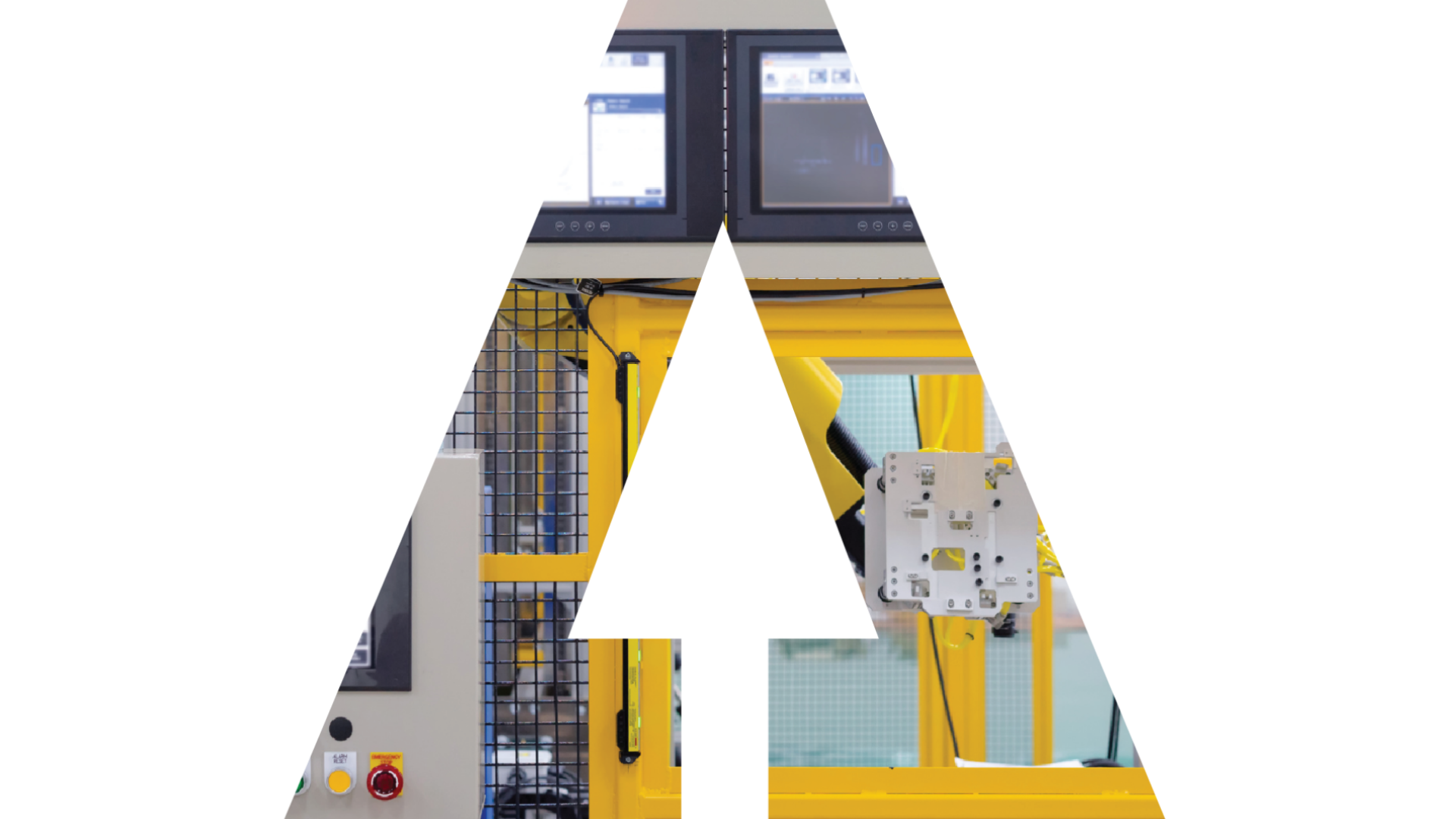
Manufacturing is an integral and huge part of the economy and plays an essential and fundamental role in accelerating progress toward global development. With the rapid development of information technology and the continuous deepening of the digital transformation process, AI is gradually applied in the whole lifecycle of manufacturing and this trend is expanding. The AI for Manufacturing discovery series, organized in partnership with the United Nations Industrial Development Organization (UNIDO), provides a forum for leading research, policy insights, and best practices across various sectors. It focuses on how AI technologies can be applied to benefit the manufacturing domain, not only at the product lifecycle management level but also at the levels of smart factories and intelligent supply chains. The series draws on a wide range of techniques, including modeling and simulation, digital twins, blockchain, 5G, and edge computing.
- Lihui WangProfessor and Chair of Sustainable Manufacturing, KTH Royal Institute of Technology

GeoAI
Geospatial AI (GeoAI), the emerging scientific discipline at the intersection of geospatial data and artificial intelligence, is the new frontier of technological innovation that promises to transform entire business industries. Geographic information systems (GIS) have been used widely to present a view of our world based on geographic and geospatial data. Started as the basic capability to visualize information on maps to improve efficiency and decision-making, GIS has conceptually evolved to include the Digital Twin Earths for revisiting the past, understanding the present and predicting the future. Nowadays we are undergoing significant new developments expanding the use of geographic data in a way that promises to disrupt entire sectors as energy, transportation, healthcare, agriculture, insurance and institutions in the public/private sector (weather centres, national labs) Behind the rise of geospatial AI are three trends: increased availability of geospatial Earth Observation data both from flying (satellites, airplanes, and UAVs (unmanned aerial vehicles) and on the ground sensors, the advancement of AI (particularly machine and deep learning), and the availability of massive computational power. The GeoAI discovery series provides a forum for leading voices in the fields of geospatial and AI across private sector, academia, governments, and international organizations, to describe the latest research and real applications of GeoAI to solve global challenges.
- Maria Antonia BrovelliProfessor, Politecnico di Milano

ML5G
Many stakeholders in the information and communication technology (ICT) domain are exploring how to make best use of AI/ML. But applying AI/ML in communication networks poses different challenges than applying machine learning in, say, image recognition or natural language processing. The reasons are:
- Time scales vary a lot in communication networks, from annual (e.g. your subscription to a telecom provider) to millisecond timescales. If your network parameters changes on a millisecond timescale, you need to (re)train your ML model on a similar timescale.
- The network environment is noisy.
- Computing resources in a network are limited.
5G, combined with AI, will make significant contributions in healthcare, education, agriculture, energy, manufacturing and transportation, among others. This technology will transform these sectors by providing significantly higher speed and lower latency for people, devices and applications. ITU has been at the forefront to explore how to best apply AI/ML in future networks including 5G networks. Please see the “AI (Pre-)Standardization Section”.
- Vishnu Ram OVIndependent Research Consultant, International Telecommunication Union (ITU)

AI and Robotics
Advances in AI are driving the development of autonomous systems with a physical presence that can not only perform multiple tasks with ease but also analyze, learn, and self-improve in dynamic environments. The AI and Robotics discovery series explores the latest innovations and trends in embodied intelligence, including AI-powered robots, autonomous vehicles, unmanned aerial vehicles (drones), and other smart machines. It highlights how these technologies can be harnessed to address some of the world’s most pressing challenges and examines the technical foundations driving these advances, including machine learning, computer vision, natural language processing, robotics hardware design, and human-robot interaction. These embodied intelligent systems are already being deployed across a wide range of domains. In healthcare, for instance, surgical robots and assistive care robots are supporting telemedicine. In transportation, autonomous vehicles and delivery drones are reshaping mobility. In manufacturing, smart industrial automation is made possible through robots and collaborative robots (cobots). In education, robotic tutors and telepresence tools are enhancing remote learning experiences. In public safety, disaster response drones and search-and-rescue robots are saving lives in critical situations. This series provides a forum for transformative collaboration in AI and robotics for the benefit of humankind. Discover some of the most impactful areas of embodied intelligence and robotics from leading experts, and share your thoughts, questions, and ideas on how we can shape a better future together.
- Guillem Martínez RouraAI and Robotics Programme Officer, International Telecommunication Union (ITU)

Trustworthy AI
Artificial Intelligence (AI) systems have steadily grown in complexity, gaining predictivity often at the expense of interpretability, robustness and trustworthiness. Deep neural networks are a prime example of this development. While reaching “superhuman” performances in various complex tasks, these models are susceptible to errors when confronted with tiny (adversarial) variations of the input – variations which are either not noticeable or can be handled reliably by humans. The Trustworthy AI discovery series discusses the challenges of current AI technology and presents new research aiming at overcoming these limitations and developing AI systems which can be certified to be trustworthy and robust.
- Wojciech SamekProfessor, Fraunhofer Heinrich Hertz Institute (HHI)

AI and Health
The health sector, one of the most important sectors for societies and economies worldwide, is particularly interesting for AI applications, given the ongoing digitalization of health data and the promise for an improved quality of health and healthcare. Many investigators from the machine learning community are driven to applying their methodological tool kits to improve patient care, inspired by the impressive successes in image analysis (e.g. in radiology, pathology and dermatology). However, due to the complexity of AI models, it is difficult to distinguish good from bad AI-based solutions and to understand their strengths and weaknesses. ITU, WHO, and WIPO established the Global Initiative on AI for Health (GI-AI4H) to enable, facilitate, and implement AI in healthcare, following the work of the ITU/WHO Focus Group on “AI for Health”.
- Matthias GroeschelResident physician, Charité - Berlin University of Medicine
- Isaac KohaneChair of the Department of Biomedical Informatics, Harvard Medical School

AI for Biodiversity
As reported in WWF’s 2024 Living Planet Report, the average size of wildlife populations declined 73% between 1970 and 2020, largely due to unsustainable human activities. Biodiversity is essential for the processes that sustain all life on Earth, including humans. As more species edge closer to extinction, restoring and preserving nature requires urgent and large-scale investment, effort and innovation. AI can play a vital role in protecting wild animals and plants in new and transformitive ways.
For decades, conservationists, governments, scientists, and hobbyists have leveraged AI to process sensor data related to biodiversity. But effective AI application goes well beyond data analysis. This iteration of the Biodiversity Series will focus on the enabling conditions necessary for impactful AI applications for biodiversity. Topics include: how AI and biodiversity plays out globally; AI and decision making in conservation; the role of socioeconomic data; the importance of techniques like federated AI to protect data sovereignty; multimodal applications; the trustworthy application of AI technology specifically in the conservation context; and the integration of AI into private sector applications.
Emphasizing both the urgency of halting biodiversity loss and the potential of AI to support that mission, this series brings together the AI and biodiversity communities to identify potential scope for collaboration to explore new opportunities for collaboration. Together, we aim to overcome key challenges and scale up solutions to protect life below water, on land, and beyond.
- Mike GillDirector, NatureServe’s Biodiversity Indicators Program
- María Cecilia LondoñoSenior Researcher, Biodiversity Assessment and Monitoring Program, Humboldt Institute
- David ThauGlobal Data and Technology Lead Scientist, WWF
- Lily XuAssistant Professor, Columbia University
- Sara BeeryProfessor, Artificial Intelligence and Decision-Making, MIT EECS

AI and Finance
Artificial intelligence promises to transform every aspect of our lives, from the way we communicate to how we drive, learn, consume energy, and obtain healthcare. There is no area where this is more true than financial services. However, the disruption of the finance sector by AI has only just begun. While AI models are being used in trading and portfolio management, and large language models are being used for information consumption and image generation, artificial intelligence is just on the cusp of stimulating changes in lending, investing, insurance, cybersecurity, infrastructure, and much more. The AI and Finance discovery series provides an important forum for leading experts in finance, economics, law, policy, and engineering to discuss the transformative impact of AI on finance.
- Sarah HammerExecutive Director, The Wharton School, The University of Pennsylvania Law School

AI and Work
While past fears over automation primarily concerned blue-collar workers, recent advancements in AI have revealed the potential for automating cognitive tasks. It is thus not surprising that many of today’s workers report fearing for their job or for the jobs of their children. But the effects of AI at the workplace go beyond potential redundancy, as the more likely outcome is the transformation of jobs, with important implications for job quality. In partnership with the International Labour Organization (ILO), the AI and Work discovery series will explore the opportunities and challenges presented by AI in the workplace. With invited speakers from economics, law, industry and labour studies, the series will delve into how AI technologies are reshaping jobs and skills requirements, the use of AI-driven decision-making in hiring and management, and the implications for productivity, inequality and the nature of work itself.
- Janine BergSenior Economist, International Labour Organization (ILO)
- Pawel GmyrekSenior Researcher, International Labour Organization (ILO)

Open Source AI for Digital Public Goods (OSAI4DPG)
With the recent advances in AI, and in particular generative AI, there is a growing interest from the public sector to invest in AI developments to facilitate and improve public services. AI usages in the public sector span from simple redundant tasks automation, to more advanced chatbots to serve citizens and to decision support tools to improve public policies, investment and services. AI holds great promise in supporting better country public services and ITU is actively contributing to raising awareness and providing education and training on the potential uses and risks of AI in public services to help countries build capacities and move forward. Under the patronage of its EU-funded Open Source Ecosystem Enabler (OSEE) project and the ITU OSPO, this discovery series will discuss the compelling requirements of trustable, auditable and equitable AI-based public services. A key focus of this discussion will be on the importance of Retrieval Augmented Generation (RAG) and the fine-tuning of open-source AI for Low and Middle-Income Countries (LMICs), particularly when resources are scarce. RAG techniques can significantly enhance the efficiency and effectiveness of AI implementations in these contexts, making them more viable and impactful. This track will explore the impact of open-source AI on enhancing the technological capabilities of industrial sectors worldwide, while also supporting domestic technology development, research, and innovation in developing countries.
- David MansetSenior Advisor Open Source and Digital Public Infrastructure, International Telecommunication Union (ITU)
- Roman ChestnovDigital Services Project Officer, International Telecommunication Union (ITU)
- Daniel BrumundAI advisor, GIZ
- Lea Gimpel AI & Country Policy Lead, Digital Public Goods Alliance (DPGA)

AI in Humanitarian Action
The humanitarian sector has been actively exploring the integration of AI, with each organization independently experimenting and deriving valuable insights. These efforts span technical, data management, financial, cultural, and linguistic dimensions. However, the broader humanitarian community has yet to fully benefit from these dispersed findings. To maximize the potential of AI in humanitarian contexts, it is crucial to foster a more integrated approach that consolidates these lessons and promotes collaborative learning. The AI in Humanitarian Action discovery series, in collaboration with AI for Good, seeks to bring together a wide range of stakeholders to share their experiences and learned lessons. Coordinated by UNOCHA and the IASC secretariat, this series aims to foster a more cohesive and integrated approach to AI in humanitarian contexts, enhancing the collective impact and effectiveness of AI-driven initiatives.
- Nyalleng MoorosiResearch Fellow, The Distributed AI Research (DAIR) Institue
- Michael TjalveFounder of the Humanitarian AI Advisory and Senior Artificial Intelligence Advisor, United Nations Office for the Coordination of Humanitarian Affairs (OCHA)

From Molecules to Models
Join us for the From Molecules to Models discovery series, where leading experts from the ELLIS Programs present their cutting-edge research and innovations in AI. This is a unique opportunity to engage with high-impact topics across various AI fields, from semantic and symbolic learning to breakthrough applications that are shaping the future of technology. The European Laboratory for Learning and Intelligent Systems (ELLIS) is a top-tier initiative dedicated to advancing AI research in Europe. ELLIS unites some of the brightest minds in AI across Europe’s leading institutions, fostering a collaborative, interdisciplinary network of researchers. Its mission is to address the most pressing challenges in AI, from deep learning to interpretable AI, and to ensure that European research remains at the forefront of AI development. The ELLIS Programs are a network of cutting-edge research programs focused on high-impact AI challenges. Led by distinguished researchers and supported by leading Program Fellows, these programs drive collaboration across Europe to push the boundaries of modern AI. Inspired by the CIFAR Program model, ELLIS Programs also collaborate with the CIFAR LMB (Learning in Machines and Brains) Program, creating an environment for intensive scientific exchange.
- Conrad PhilippSenior Project Coordinator, Friedrich Schiller University Jena
- Arnout DevosScientific Coordinator, European Laboratory for Learning and Intelligent Systems (ELLIS)

ITU Journal
The ITU Journal launched a series of webinars to present insights and forward-looking research on future and evolving technologies. Free of charge and open to all interested individuals, these webinars provide an opportunity to learn and discuss key areas of research with prominent researchers, highly cited professors and industry leaders, sharing their vision and pioneering studies on future technology evolution and trends, as well as their impactful life lessons learned over the years.
The webinar series is curated by the Editor in Chief of the ITU Journal on Future and Evolving Technologies (ITU-J FET), Professor Ian F. Akyildiz (President and Founder, Truva Inc., United States) and the ITU Journal Manager, Alessia Magliarditi.
- Ian F. AkyildizITU J-FET Editor-in-Chief and Truva Inc., USA
- Alessia MagliarditiITU Journal Manager, International Telecommunication Union (ITU)

Quantum for Good
While quantum technologies were once confined to physics labs, they are now emerging as powerful tools transforming communication, computing, security, and science itself. Their convergence with AI opens new frontiers with impact across industry, governance and society. The Quantum discovery series showcases the ecosystem powering this transformation. It maps the building blocks of quantum technologies and highlights how innovators, investors, and policymakers shape scalable networks and services, while nurturing the talent and infrastructure needed for long-term growth. By connecting voices across disciplines and regions, the series offers a unique window into the global quantum economy taking shape today.
- Gillian MakamaraProject Officer, International Telecommunication Union (ITU)
- Sanskriti DevaQuantum Product Marketer, IBM Quantum
- Cierra ChoucairCEO, Universum Labs, Strategic Content Director, The Quantum Insider

Environmentally Sustainable AI
This webinar series offers a multi-disciplinary examination of AI’s environmental impact. As AI models, particularly Large Language Models (LLMs), continue to grow in complexity, their associated energy and water consumption and carbon footprint require systematic innovation and management. This series provides an evidence-based approach focused on the technical steps necessary for Building environmentally efficient AI, thereby achieving long-term Sustainable AI.
The series focuses on three core areas. First, quantifying the problem: presenters will discuss empirical data on resource usage, establishing a factual foundation for assessing the environmental footprint of current AI systems. This will include discussion of energy and water consumption, carbon emissions, and relevant KPIs, as well as which metrics are already available, and which additional indicators are needed to support robust measurement and comparability.
Second, engineering the solution: this segment explores technical advances required for increased efficiency. Innovator will present research and methods in software optimization (e.g., algorithmic efficiency and model pruning) hardware and infrastructure efficiency (e.g., low-power architectures), as well as data centers energy efficiency and cooling solutions, highlighting how more energy-efficient AI systems can be designed and deployed in practice.
Third, guidelines and transparency: this segment features experts discussing frameworks, guidelines, and standards for long-term Sustainable AI. It will examine initiatives aimed at improving transparency in energy, water, and resource consumption, supporting consistent reporting, and enabling the use of common KPIs for the assessment and ongoing improvement of AI systems’ environmental performance, including through scientific, standards and industry-led approaches.


