 Register here
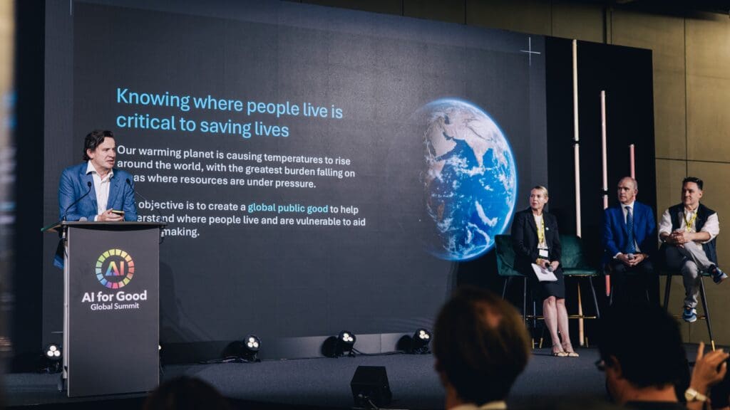
In the face of accelerating climate risks and natural hazards, timely and inclusive communication has become essential to protect those most at risk. Responding to this challenge, the Early Warning Connectivity Map (EWCM) was introduced during the 2025 AI for Good Global Summit as a joint initiative by the International Telecommunication Union (ITU), Microsoft, Planet Labs, and the Institute for Health Metrics and Evaluation (IHME). The project uses AI and satellite imagery to map where people live and whether they are connected to mobile networks, enabling governments and partners to better target vulnerable populations who are currently beyond the reach of emergency alerts.
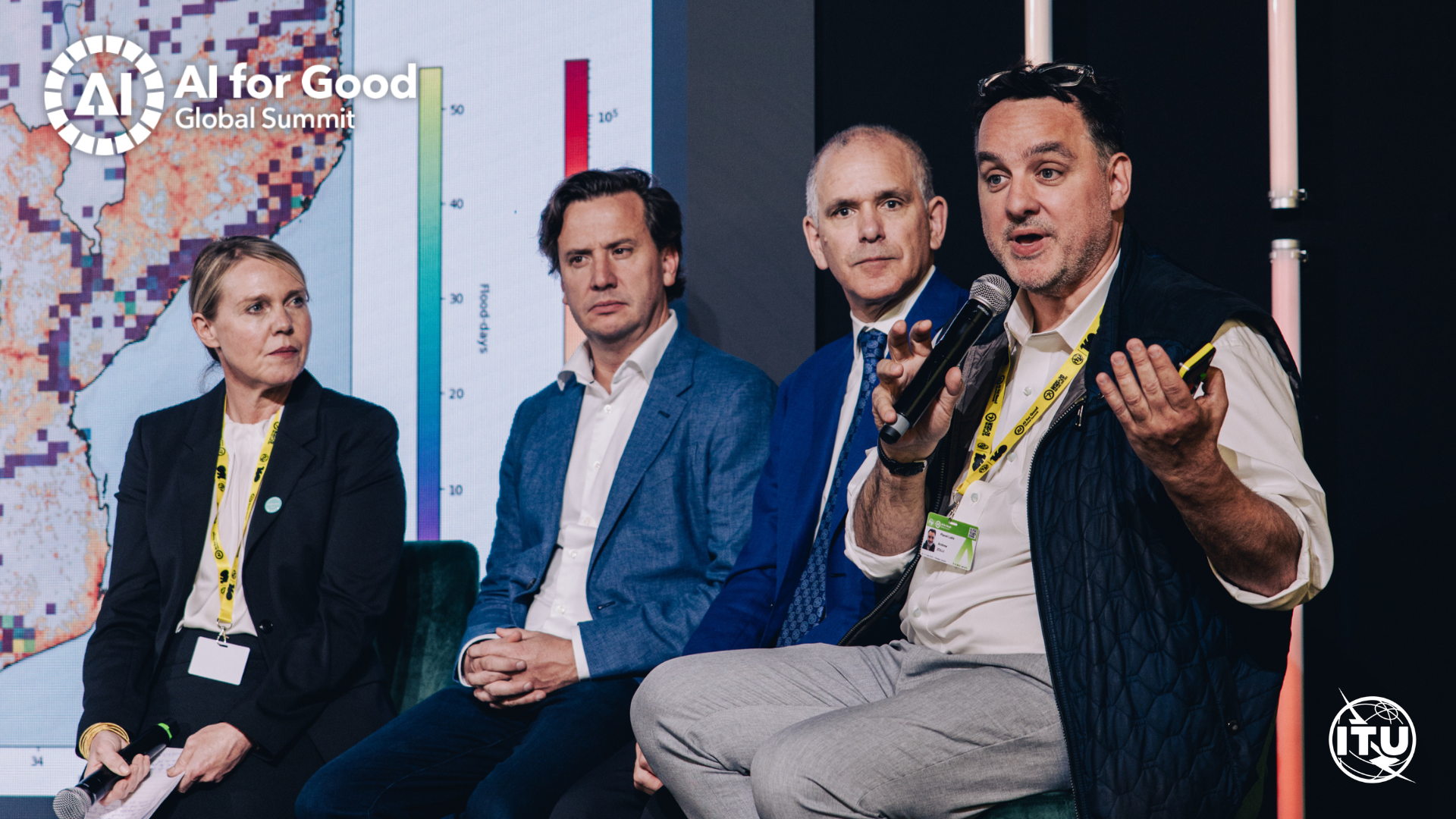
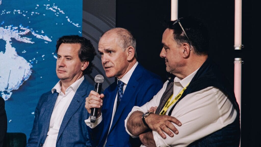
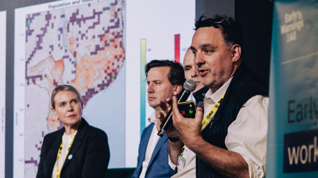
The panel was moderated by Vanessa Gray, Head of the Climate and Emergency Telecommunications Division at ITU’s Telecommunication Development Bureau. It featured speakers from all project partners, including Doreen Bogdan-Martin, ITU Secretary-General; Juan Lavista Ferres, Chief Data Scientist at Microsoft’s AI for Good Lab; Professor Christopher J.L. Murray, Director of IHME; and Andrew Zolli, Chief Impact Officer at Planet Labs.
Partnerships for early warnings

The Early Warning Connectivity Map (ECM) focuses on developing new tools and solutions that are piloted in countries supported by the Early Warnings for All initiative.
“We first of all identify gaps that we see in early warning systems and then we make the connections, connect the dots, and we build concrete solutions to specific challenges,” explained Vanessa Gray.
One of the most persistent challenges is reaching those most at risk. “How can we reach with alerts people who are at risk in times of crisis?” she asked, setting the stage for the collaborative project.
United Nations Secretary-General António Guterres has called for all countries to establish early warning systems by 2027. This ambitious target anchors the Early Warnings for All initiative, led by ITU alongside the United Nations Office for Disaster Risk Reduction (UNDRR), the World Meteorological Organization (WMO), and the International Federation of Red Cross and Red Crescent Societies (IFRC).
The ECM combines AI and satellite imagery to produce high-resolution population density maps, allowing identification of areas that remain beyond mobile network reach. The result is a precision tool that enables targeted interventions.
“We are putting artificial intelligence and cross-sectoral partnerships in action to build more reliable, resilient, and inclusive early warning systems. Because in disasters, every second counts,” said ITU Secretary General Doreen Bogdan-Martin.
She also announced the launch of the precision population early access collaboration program, inviting partners from both the public and private sectors to contribute data and engage with the initiative.
Mapping the invisible
The project was driven by the realization that, contrary to common assumptions, many parts of the world are poorly mapped. Juan Lavista Ferres noted that in many regions, available satellite imagery is outdated (sometimes 10 to 15 years old) and in that time, some countries have doubled their population. As a result, large portions of the population may not appear on any map, making it impossible to reach or assist them effectively.
“If the people are not in any map, there’s no way for you to help them,” said Lavista Ferres.
The project combined Microsoft’s AI expertise, Planet Labs’ daily satellite imagery, IHME’s demographic modeling expertise, and ITU’s cell tower data to determine which populations are connected and which are not. Lavista Ferres explained that by overlaying population and connectivity data, the team was able to identify who remains unconnected.
“No matter how much technology you have, if the people cannot get an alert, then all your technology is useless.”
A case study from the Solomon Islands revealed areas of both connected and unconnected populations. The maps showed that certain cities remained completely out of reach of existing alert systems, highlighting gaps in coverage. Lavista Ferres expressed confidence that the approach could fundamentally change how countries and organizations prioritize their risk reduction efforts.
Precision data for risk and health
The success of such initiatives depends on granular population data, which is essential for both public health and risk assessment. While the Institute for Health Metrics and Evaluation has long used census and survey data to estimate populations, these models are often too coarse to address environmental risks and crisis-related threats effectively.
“These risks are really local – storms, malaria, child malnutrition – and to understand them, you really need to have much more granular mapping” said Christopher J.L. Murray. “That precision helps us see who’s at risk now and in the next five, ten, even 25 years. Through collaboration, we can make this a global public good.”
He stressed that even factors like air pollution are highly localized, and that demographic shifts will significantly influence where resources and attention need to be focused over the coming decades.
From Earth to space
Andrew Zolli explained how satellite imagery fills a critical gap in global situational awareness –.
“We live in a world of enormous, complex, self-compounding, and sometimes deeply unobvious forms of risk […]. The challenge […] is that we first have to make the invisible visible,” said Zolli.
Planet Labs operates the world’s largest constellation of Earth-observing satellites, capturing 40 terabytes of high-resolution imagery each day. This daily coverage enables partners to monitor changes across the planet and apply AI and demographic analysis to produce accurate population estimates, even in the most remote areas.
The goal is to capture a comprehensive picture of the world and make that information accessible to those working on complex, overlapping risks. Use cases extend beyond early warning, including tracking disease spillover zones, assessing wildfire risk, and planning public infrastructure such as schools and hospitals, all of which depend fundamentally on knowing where people are located.
Mobilizing for greater coverage
To broaden access, the partners launched an early access collaboration program, aimed at organizations interested in using the precision mapping data. The goal is to refine the product input from real-world users and eventually make it available as a global public good.
Vanessa Gray closed the session by reflecting on the broader ambition behind the ECM and its role in achieving universal coverage.
“What we’re producing is allowing us first of all to support countries in developing better, more resilient, and more inclusive early warning systems,” Gray said. “It’s also helping us to achieve the very ambitious goal of the early warnings for all initiative, which is to make sure that every person on earth is protected by an early warning system.”
She concluded by inviting anyone involved in early warning systems or AI to join the AI for Early Warning for All group, expressing enthusiasm about collaborating with new partners.